From Hiking to Trail Running: Discover Niseko’s Untamed Beauty
Explore Niseko’s best hiking and trail running routes with tips on gear, safety, and planning for an unforgettable summer adventure in Hokkaido.
Niseko may be world-famous for its legendary powder snow, drawing winter sports lovers from around the globe, but its magic doesn’t end with the snow season. As the landscape thaws, Mt. Yotei and the Niseko Mountain Range, spanning nearly 100,000 acres, transform into a vast playground for hikers and trail runners. A network of scenic trails emerges beneath the melting snow, offering breathtaking routes through alpine forests and volcanic terrain. It’s no wonder even The North Face has taken notice.
The Right Preparation Makes All The Difference
Whether you're heading out for a scenic hike or tackling a challenging trail run, good preparation is key to having a safe and enjoyable experience in Niseko’s great outdoors. Start by mapping out your route and ensuring you have a reliable way to navigate while out on the trails. Websites like Komoot, AllTrails, and the trusted local resource HokkaidoWilds.org are fantastic for finding trails and planning your journey. To avoid losing your way, use activity apps with downloadable offline maps, YAMAP is a particularly popular choice in Japan and is regularly updated with local trail info.
Your gear should match your experience level and the conditions. At the very least, invest in proper hiking boots or trail running shoes, along with weather-appropriate clothing. Even on warmer days, long sleeves are a common and practical choice, they help protect against the sun, stray branches, and pesky mosquitoes. Don’t forget a lightweight rain jacket too, it can shield you from sudden showers and strong winds, especially at higher altitudes. In early summer, late summer, and autumn, extra layers are essential to cope with unexpected drops in temperature.
Pack smart. In your hiking pack or running vest, water is a top priority. A good rule of thumb is 500ml per hour of activity, especially on hot days. Energy is just as important, so bring along snacks such as bananas, protein bars, gels, sandwiches, or onigiri (rice balls). It’s always better to have too much than not enough. Other must-haves include sunblock, insect repellent, a bear bell, and a whistle for safety.
Read our full guide to make sure you have the right gear.
Some Things Are Out of Our Hands
When it comes to outdoor adventures, certain elements are simply beyond our control, but we can still prepare for them. The most unpredictable factor is often the weather. Even on a seemingly perfect day, conditions can shift rapidly. Sudden gusts of wind, passing rain showers, or dense fog can dramatically change your experience on the trail. Keep in mind that as you gain altitude, the weather often becomes cooler and more volatile. For example, while the base of Mt. Yotei may sit at a comfortable 20°C, the summit could be a chilly 10°C, shrouded in clouds and swept by strong winds. Having the right gear, like layers, a rain jacket, and wind protection, can make all the difference in staying comfortable.
It’s also wise to check the weather in the days leading up to your hike or run. Heavy rainfall can leave trails muddy and slippery, increase the risk of landslides, and cause streams to flow faster and deeper than expected.
Hokkaido’s wildlife is another aspect to be aware of, it's home to species found nowhere else in Japan. While encountering animals in the wild can be a memorable experience, it’s important to observe from a distance and respect their natural behaviour. The most notable is the Hokkaido brown bear, a solitary and powerful creature that plays a significant role in both Ainu culture and the region’s ecosystem. Sightings in the Niseko area are rare, but it’s still smart to take precautions. Wearing a bear bell helps to alert animals to your presence, reducing the chance of a close encounter. For added peace of mind, consider carrying bear spray as well.
The Numbers on the Route Matter
When choosing your next hike or trail run in the Niseko area, the route stats, like distance, elevation gain, and terrain, play a big role in shaping your experience. Many trail websites and apps let you set your fitness level or show estimated average times to help you gauge the challenge. Use this info to decide how long you want to be out on the trail and what kind of effort you're ready for.
Don’t be put off by big numbers at first glance. A 5 km out-and-back might sound easy, but if it climbs 800 metres, it’s more of a leg-burner than a gentle walk. On the flip side, a 12 km loop may seem daunting, but if it’s mostly flat and on well-kept trails, it could be ideal for a relaxed half-day adventure.
More Than Just Distance
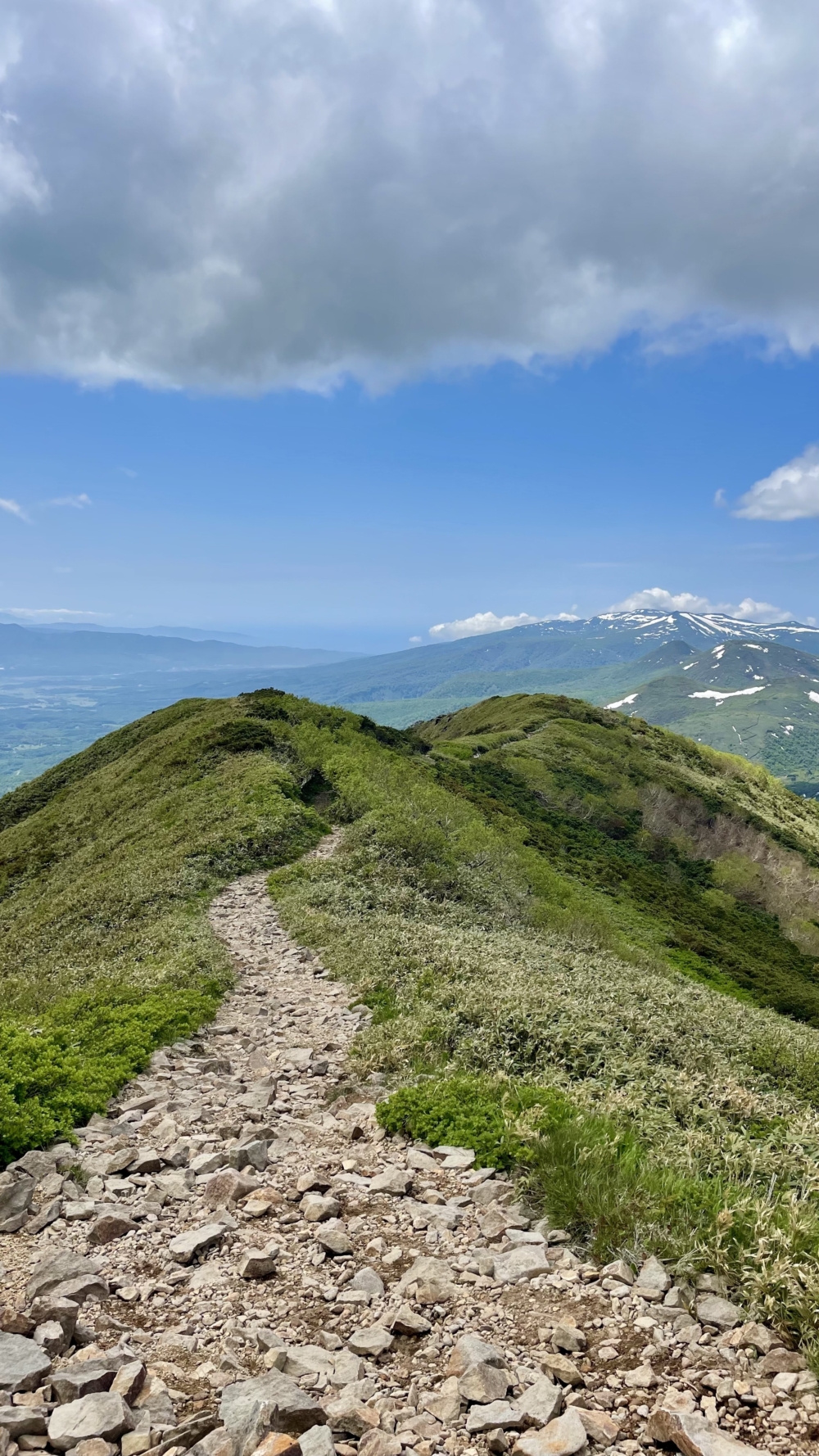
Time and effort aren’t determined by numbers alone, the condition of the trail itself also matters. Some paths are wide, smooth, and well-maintained, making for an easy outing. Others, especially those with more elevation, can feature uneven terrain, exposed roots, loose rocks, and narrow or overgrown sections. If you're not used to technical trails, it's best to take your time, move carefully, and avoid rushing through more rugged areas.
Views Worth the Climb
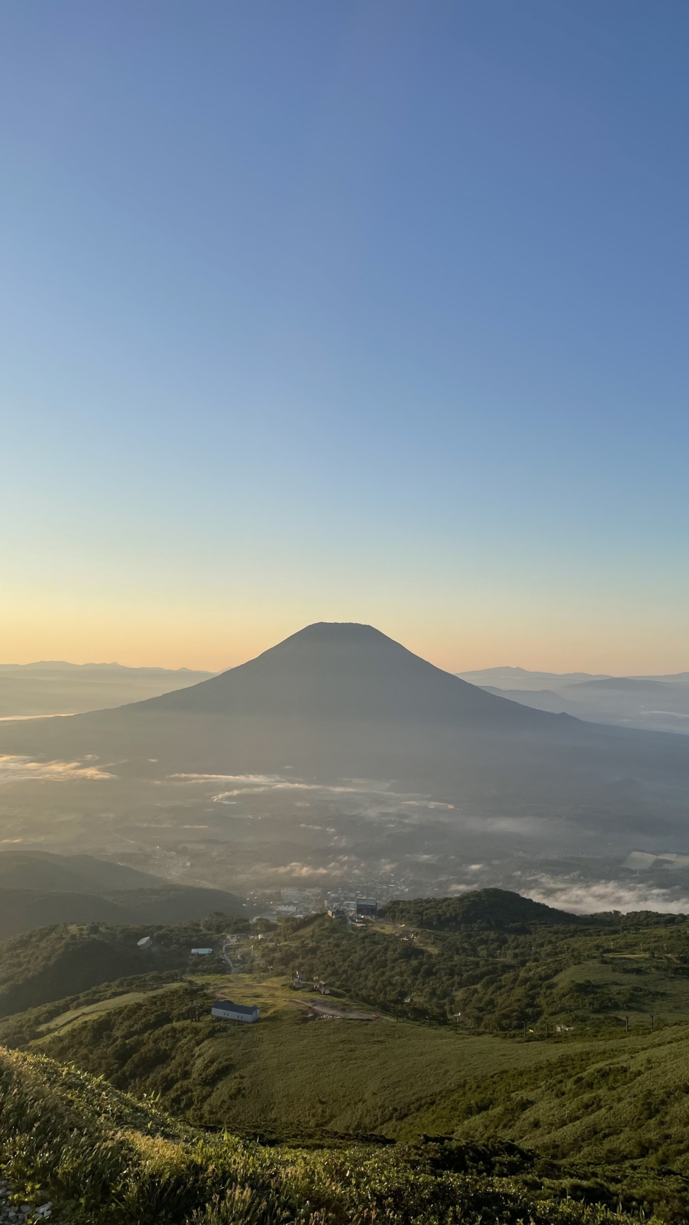
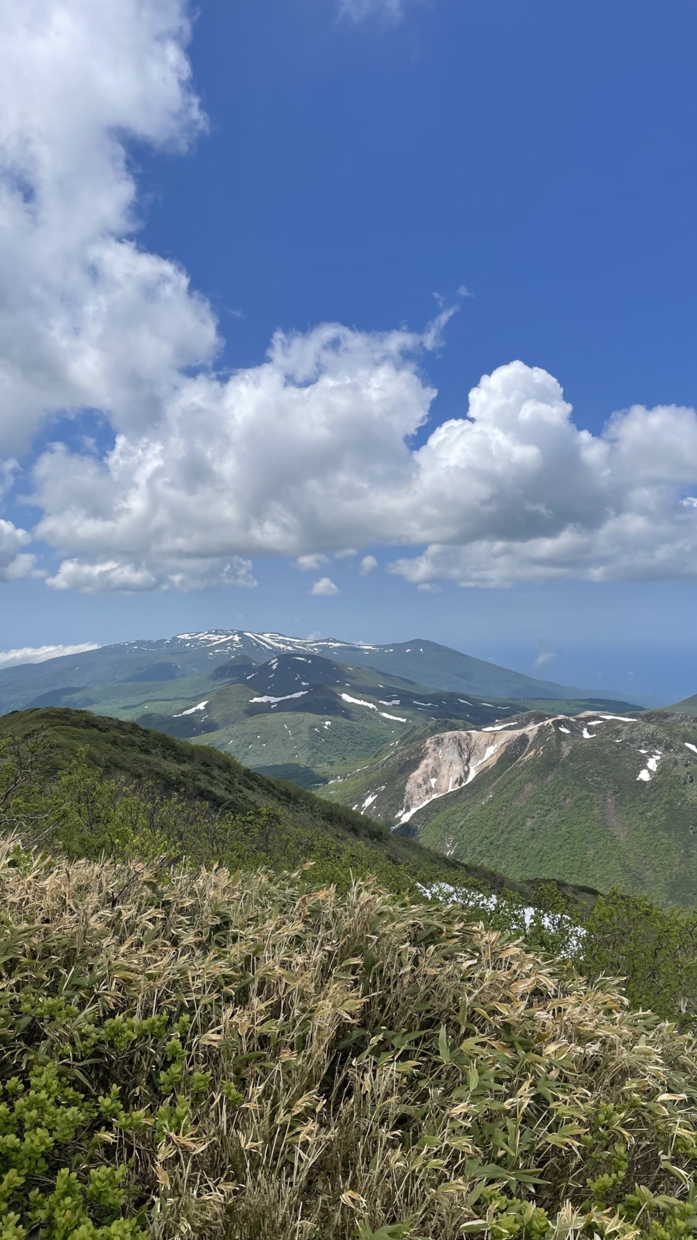
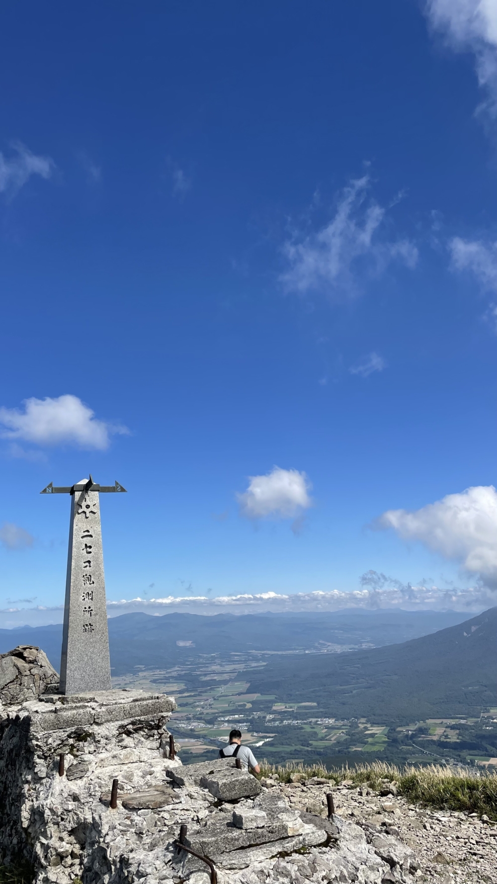
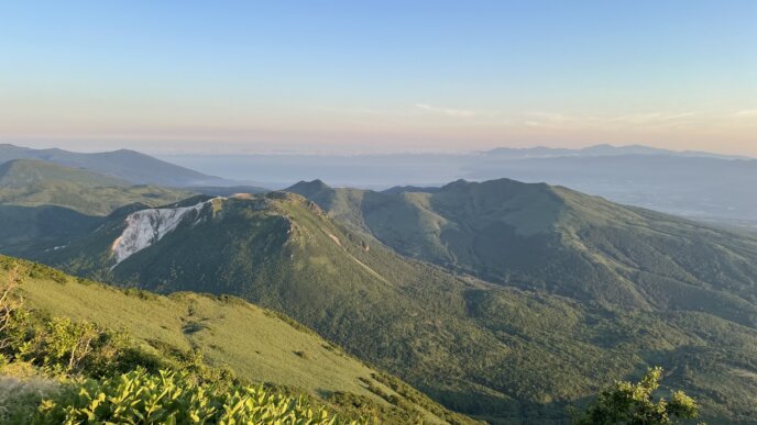
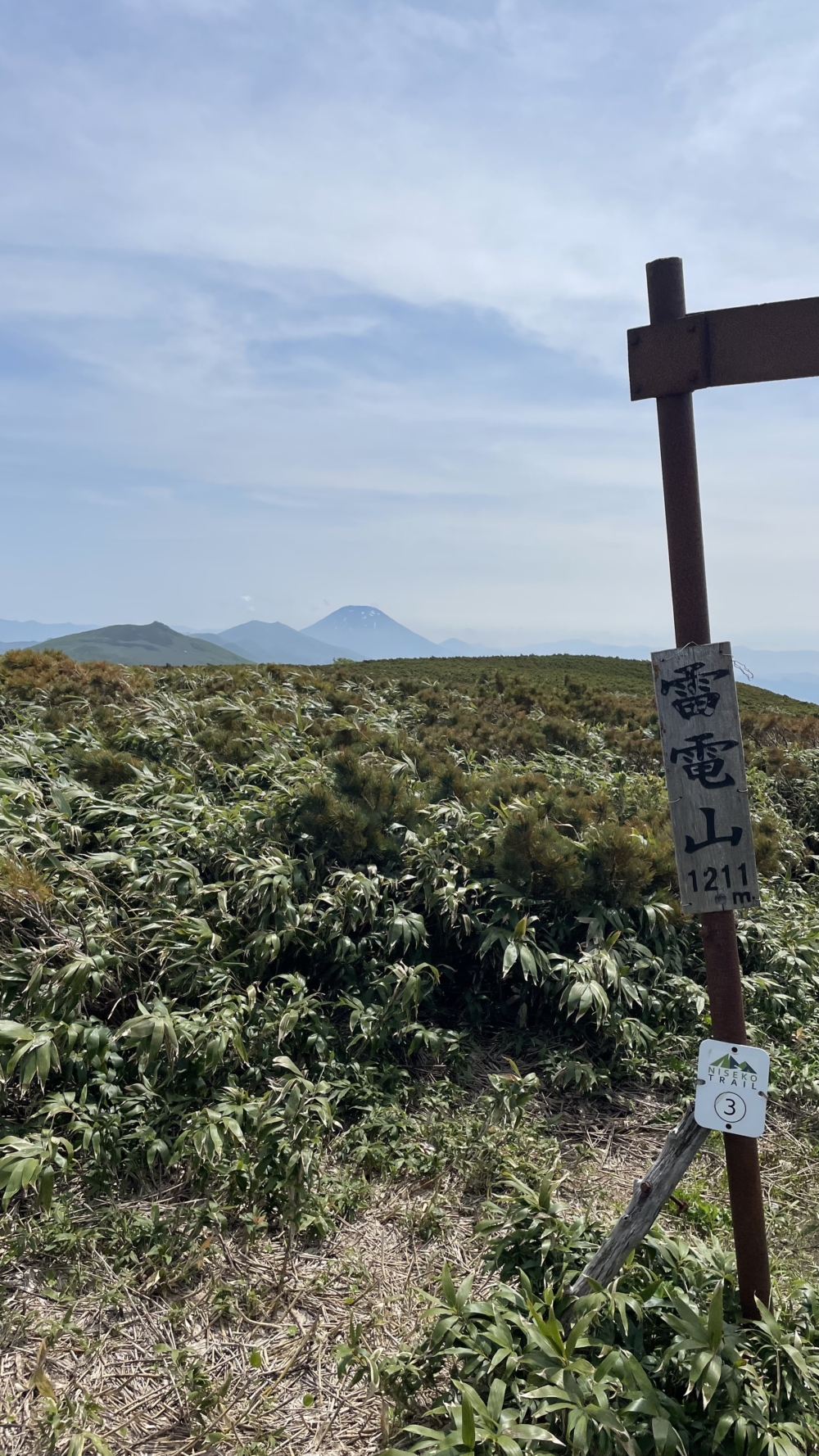
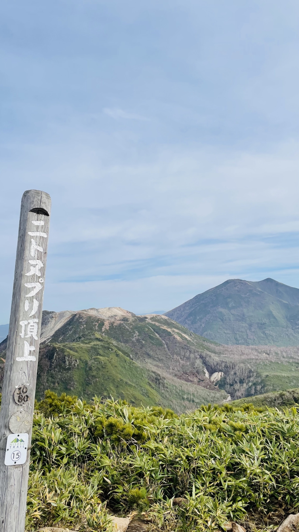
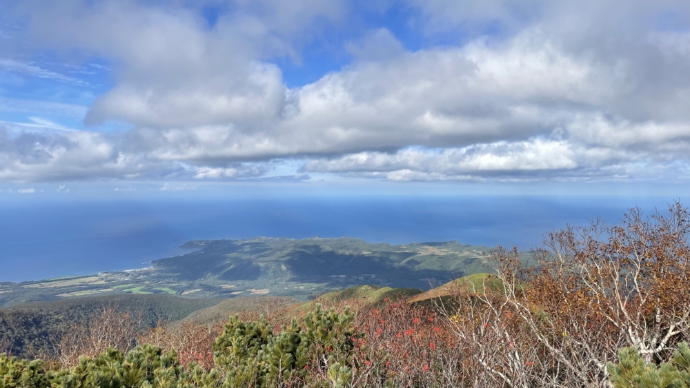
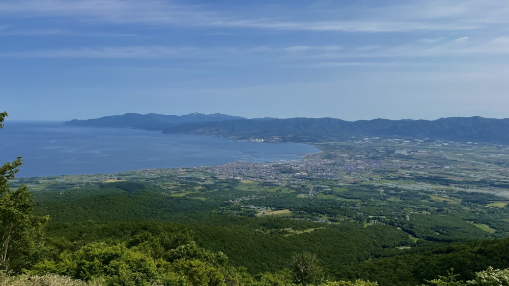
Most trails in the Niseko region reward your efforts with breathtaking views. Mt. Yotei, the tallest peak in the area, offers panoramic vistas stretching from the Sea of Japan to the Pacific Ocean. Other nearby summits provide stunning perspectives of Yotei itself, glimpses of Lake Toya in the distance, and dramatic volcanic landscapes.
Many trailheads are just a short drive from Hirafu, giving you plenty of options to suit your pace and goals. A personal favourite is the Niseko Goshiki Onsen Information Center, which connects to a range of trails in all directions. Bonus: the drive there along the scenic Panorama Line is almost as enjoyable as the hike itself.
Niseko’s breathtaking mountains welcome every adventurer, no matter your level, explore them your way!